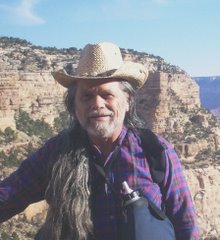
 One of my discoveries in Mississippi was the Tuxachanie Trail, which offers a 22-mile hike through southern Mississippi's Desoto National Forest. I kept returning to the trail until I had hiked all of it--or at least all of it that was open to the public (and some that wasn't).
.
 .
.One of the gems along that route was this plank bridge. The horse portion of the trail splashed for 50 yards or so through the low-lying wetlands along Spike Buck Creek, while this plank trail offered a way for hikers to get through without sloshing mud and water up into your boots. The reward on the other side of the creek was a trail camp which boasted an actual picnic table.
To Gabrielino (California)...
 .
.This past July 12 I set out to explore the Arroyo Seco northwest of Pasadena and stumbled across the trailhead for the Gabrielino Trail. I determined to learn more. Here is Gould Mesa Trail Camp, just an hour up the trail. I decided to base camp here on my next visit and try to get farther up the Gabrielino trail, perhaps all the way to the rumored "Switzer Falls".

There are a number of bridges on the trail for autos, but many of them, along with the roads around them, have been destroyed by the recurring floods. This is a more recently-constructed bridge, built to accomodate the equestrian traffic on the Gabrielino Trail.

"Arroyo Seco" is Spanish for "Dry Gulch," an appropriate name only for the lower reaches of the canyon after the City of Pasadena has sucked all the water out of it for its thirsty citizens. The lower portion of the arroyo is the pathway for the nation's first freeway, now an extension of Interstate 110. With its tight curves and abrupt on- and off-ramps, it is a challenging drive during rush hour.

Once above the intake point for Pasadena's water plant, the creek crossing shown at right is more typical of what will confront a hiker on the Gabrielino trail. Some of the crossings are quite a bit more challenging than this one, especially for me as I work with strength and balance limitations on my surgery recuperation trail.
At the Gould Mesa camp, there is a road that leads off the side, climbing to meet the Angeles Crest Highway (California 2) just above the city limits of La Cañada Flintridge. I encountered this sign, which reminded me of the time I drove up CA-2 and came across the place where the Gabrielino Trail reaches the crest of the Angeles Forest--and wished I had time to hike the trail.
 So I think that's exactly what I'll do. Bit by Bit, I'm going to see if I can reach each section of this 28.5 mile trail. Watch this space for the photos!


No comments:
Post a Comment